
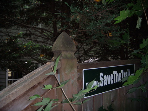
 A "Save the Trail" sign on the Capital Crescent Trail in Chevy Chase.
 - Opponents of putting the Purple Line on the Capital Crescent Trail held a "No Rail on the Trail" run on Saturday. The Post article briefly mentioned (until late last night, when it quietly disappeared) that the event wasn't held on any part of the trail where the transitway would actually go, instead traveling south from Bethesda to MacArthur Boulevard into the District. If built, the Purple Line would use the Capital Crescent Trail from Bethesda east to Silver Spring before continuing to New Carrollton in Prince George's County.
- A slew of last-minute entrants mean there are now TEN candidates for the open District 4 County Council seat, including six Democrats, three Republicans and one person from the Green Party. Wow! It looks like JUTP's 2009 District 4 Head-to-Head Tour will be more intense than ever. All I have to do is, uh, actually interview the candidates . . . good thing they pushed the election date back after all.
- I didn't realize that Jeff Krulik, the producer of the documentary on Led Zeppelin's alleged performance at the Wheaton Youth Center forty years ago, also made Heavy Metal Parking Lot, about heavy metal fans at the Capital Centre in 1987. His open house at the former Youth Center (now the Wheaton Community Center) on Georgia Avenue was profiled in the Post.
7 comments:
The misplaced attitudes of some of the self described "trail advocates" at this event is shown in the Post article where one of the Purple Line opponents "....showed walkers a swath of her back yard that she said would be lost to the proposed project".
But it is not, and never has been, her back yard. The Georgetown Branch Corridor that the public owns is more than wide enough for both the trail and transit. No part of any of the adjacent private back yards will need to be taken. If that woman's "back yard" is being used for the Purple Line, that means she has been encroaching on the publicly owned r.o.w., and apparently wants to continue to do so.
Join me on a walk of the trail this Saturday, and see for yourself. Details at www.finishthetrail.org
One of the endless questionnaires a candidate receives pass through my mailbox within the last few days. Chock full of loaded questions, one of these asked that I discard commonsense in pursuit of votes.
I'm trying to understand how putting the entire Purple Line in a tunnel is "the most environmentally sound". I'm guessing that whoever wrote that question has never seen a tunnel being dug.
For the parts of the Purple Line that would run under the trail, the most sensible construction approach -- all others are essentially unaffordable -- is a cut-and-cover, and that's not "environmentally sound" unless you consider old-school strip-mining to be "environmentally sound". Oh, in the end, a tunnel would be a little less problematic for deer trying to cross the right-of-way, regardless of how you dig the tunnel.
I'm writing off that question as the result of an incapacity to reconcile the need for more public mass transit on an east-west alignment that would benefit potentially tens of thousands of persons per day, with a desire to preserve someone's favorite walking spot that benefits maybe a few hundreds a day. Apparently the only way that they can reconcile it is to demand that millions of people should octuple their taxpayer debt obligations.
I should note here that I intend to be the most pragmatic and least retionalization-driven candidate in the District 4 Special Elections.
Silverspringtrails, for those people joining your walk on Saturday, please be sure to point out that Bus Rapid Transit would also complete the Trail into Silver Spring and it would do so in a more environmentally friendly way. That is because Bus Rapid Transit allows the replanting of mature trees next to the tracks. Light rail does not because leaves and branches pose problems to both the catenary wires and the tracks. So, Webb Smedley's comments in the article were flat wrong in stating the trees could/would be replanted. When they go down, they go down forever.
Also be sure to mention that using a Jones Bridge Road alternative would not negate the completion of the trail into Silver Spring either.
As to the the Georgetown Branch Corridor being wide enough for both the trail and transit, depends on how you define safe and multiple user friendly. A 10 foot wide trail with no shoulders in the 66 foot right of way is not safe. If they want to make the Trail safer by widening it to 12 feet with 2 foot shoulders on each side as the County has suggested, they will have to go onto people's property.
Pat:
Yes, I certainly will mention BRT on Jones Mill Road, and the fact that after careful study and thorough discussion of the issue the Planning Board voted 5-0 against using a Jones Bridge Road alignment. It just didn't compete for ridership or cost effectiveness with BRT on the Georgetown Branch. See the BRT on JBR series at www.finishthetrail.org for a summary of the BRT issue. You are beating a dead horse to push BRT on JBR.
I also ask you to check your math, or else look at some of the profiles developed by MTA for the proposed LRT design. The trail can be 12' wide, with a 2' shoulder on both sides, AND the LRT can take the 30' it needs for two tracks, and you still have 20' left for a buffer between the trail and LRT, and on the sides.
I have said repeatedly "the tail should not wag the dog". More people are projected to board the Purple Line at the Bethesda Station in one day than there are uses of the Interim CCT at Bethesda in an entire week. And that is only counting boardings at one station on the future Purple Line. Trail users cannot reasonably expect these many more thousands of future transit users to take a longer trip on buses down Jones Bridge Road and Woodmont Ave. to go between Silver Spring and Bethesda, and to also use buses on the whole 16 mile Purple Line system, because SOME trail users don't want to have a short part of the CCT lose some of its park character.
Wayne, I'm sorry. I thought your tour was focusing on the Trail. If you also want to discuss the overall validity of the project as proposed, you should also ask your walkers if they really think $1.2 billion + about $100 million in additional County expenditures is worth 62,000 riders when $600 million can get you 56,000 riders for the Purple Line and also get you a Corridor Cities Transitway.
As to the JBR alternative, the State still has to answer concerns raised by comments to the DEIS as to the validity of their ridership estimates for that alternative -- that question was not just raised by the Town but also by National Naval Medical Center.
And, finally, there will not be a 12 foot trail plus 2 foot buffers anywhere in the 66 foot right of way. Period.
Pat:
You said "And, finally, there will not be a 12 foot trail plus 2 foot buffers anywhere in the 66 foot right of way. Period."
I'm curious how you can be so certain of that. The County Council and Executive have recommended the trail be 12' wide, and MTA has acknowledged that is possible. Anyone who can add can confirm that it is possible to have a 12' trail and 2' shoulders with a 30' wide LRT within a 66' r.o.w. It will be a political decision, not an engineering problem, whether the trail will be 10' wide or 12' wide in the 66' section. If we tell the engineers it must be 12' wide, it will be a trivial engineering problem.
Maybe if you would join us and push for a 12' wide trail, instead of continuing to beat a dead BRT on JBR horse, you could help us make sure the political decision is for the wider trail.
Wayne, again -- you will not see expanded widths for the trail in the 66 foot ROW unless they move onto private property.
But, don't worry, we'll join in fighting for a safer trail . . . that is another reason why we are so adamantly fighting trains that can travel up to 45-50 mph (they want to use the Trail to make up time they lose in Silver Spring) crossing every 3 minutes within 10 - 11 feet of a narrow trail in a narrow ROW . . .
Post a Comment