
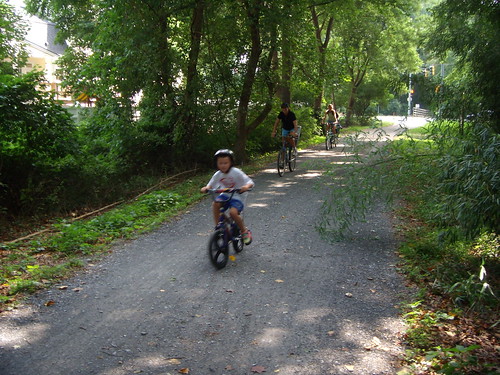
 Simple and inexpensive, bike trails like the Capital Crescent Trail (pictured in Bethesda) offer an alternative to driving in an era of increasing gas prices and traffic. In actuality, bike paths get the short end of the stick. Here's a look at what's happening this week in trails:
For joggers and bikers in Silver Spring, the Purple Line may be the only way that the popular Capital Crescent Trail gets completed east of Rock Creek Park. As the MTA nears its decision on how and where to build the proposed transitway between Bethesda and New Carrollton, those on both sides have stepped up their game recently, from reaching high school students to launching a "grass-roots coalition" bankrolled by the exclusive Columbia Country Club.
While the contact page of new anti-Purple Line group Alliance For Smart Transportation lists an address in Silver Spring, suggesting a connection with the east side, their list of talking points focus on the Purple Line's effects on the trail in Bethesda, or a Town of Chevy Chase-funded study that was largely debunked by state Secretary of Transportation John Porcari.
You'd think that a so-called "Alliance" would move away from Bethesda and ally themselves with their anti-Purple Line counterparts in Silver Spring - SSTOP and the nascent "No Train on Wayne" group, some of whose members do support the project, if not in their backyards. It reminds me of my meetings last summer with activist Pam Browning, who admitted she didn't know about anything east of Silver Spring, or former Chevy Chase mayor Mier Wolf, who'd never really driven on congested East-West Highway (which parallels the proposed Purple Line route) before.
Not that I personally support the forming of a cross-county anti-Purple Line coalition, though it would be nice to see Silver Spring and Bethesda come together on something. I mean, think of all the lemonade that could come from it!
so much more AFTER THE JUMP . . .
 A redevelopment of the Burtonsville Shopping Center could include a bike path along Route 29 between Route 198 and Dustin Road.
IN ADDITION:On Thursday, the Planning Board holds a hearing for the ICC Limited Functional Master Plan, which lays out how the InterCounty Connector, currently under construction, will accomodate bike paths and interchanges. Dismayed by the highway's potential effects on the environment, many anti-ICC groups - or groups seeking more alternatives to driving - saw the State Highway Administration's plan to include a bike path parallel to the ICC as a compromise. As The WashCycle explained in a two-part series last month, the state wasn't willing to meet bikers halfway.
In 2004, SHA deleted the trail, saying it would do even further harm to local parkland and streams by increasing the paved area. And while seven miles of the path were added back to the ICC in 2007, the new route follows local roads, like New Hampshire Avenue and Fairland Road, that add extra travel time. Not only that, says the Washington Area Bicyclist Association, but they may also be more unsafe for bikers than a path next to the highway.
FINALLY: Up The Pike, a bike path makes a minor hurdle for the long-awaited Burtonsville Shopping Center redevelopment. Also on Thursday, the Planning Board will decide whether Bethesda developer Chris Jones, whose BMC Property Group will be knocking down the forty-year-old strip mall later this summer, will be required to install a trail and landscaping along old Route 29 between Route 198 and Dustin Road. The project would require cooperation with other properties north of the shopping center, including a church, a garden center and several houses, and planning staff isn't entirely sure that it's feasible to do so.
While it does concern a bike trail, the report from Park and Planning has no images what the project make look like. After years of controversy over potential "big-box" stores in the new center, Jones has returned with a plan for what he calls one the most "environmentally friendly plaza" in the country. But for all the press the Burtonsville Shopping Center over the past year, few people - outside of an East County Citizens Advisory Board meeting last month - have actually seen it.
15 comments:
Dan, where is your evidence that country club is funding that effort? Pls note the long list of real estate developers and other business interests backing PL:
http://www.purplelinenow.com/published/how_you_can_help/supporter_list.html
This project would not only have a massive footprint on small-scale, green neighborhoods -- it would keep on taking through rezoning. We are built out. Light rail belongs in areas with big, wide, flat streets running between big buildings. Rail could put in the street, and the bigness is already there.
If you go to http://www.purplelinenow.com/published/how_you_can_help/supporter_list.html you find that there are many more supporters than just business interests - such as numerous neighborhood, civic and environmental groups.
But the big difference is that those backing the Purple Line at purplelinenow.org do not hide as "anonymous". They list not only their supporters, but also their Board.
If the Country Club is not funding the anti-Purple Line effort, then why are they hiding their identity on their websites??
They could easily quell the opposition by running a first class cut-and-cover light rail line along the right of way, saving the trail and neighborhoods with only minor cost. If they did cut and cover on the Blue Line Largo extension through a suburban neighborhood with plenty of right of way, why not the pPurple Line through dense neighborhoods where kids sell Lemonade on weekends and local families go out to stroll on America's finest linear open spaces.
anonymous: see a letter Columbia Country Club sent to its members (parts one and two over at Maryland Politics Watch) in which the President says "we will be helping to launch a grassroots campaign to identify and organize a broad and diverse coalition of opponents to the current proposal for the Purple Line" and adds that "an implementation of this effort requires a commitment of financial resources."
Check it out. There may be poor people in Bethesda who oppose the Purple Line, but Columbia Country Club's bankrolling the operation.
Sanjay:
Cut and cover through just the short section of Chevy Chase is estimated to cost about $100M. It is not a "minor cost" by a long shot.
The trail will be well separated from the light rail by a fence and a 10' wide planted buffer over the great majority of its length through Chevy Chase. There will still be room for the lemonade stand, and the families can still take their stroll.
We should remember this corridor was originally purchased by the taxpayers for 10M$ for its potential use for both trail and transit. This was never intended to be for the use of Chevy Chase residents as their own local park.
Folks, I realize that everyone here seems to either support, or not support, a train.
As much as I like light rail, it's incredibly capital-intensive and even as you pull together your finished product, the situation may have changed.
I've been riding MetroRail since it first opened, and riding into town for July Fourth, I was stunned by the deterioration in ride quality over just the last five or so years, especially on the elevated sections around Rhode Island Avenue station. My point being, did Metro ever plan for this level of ridership? I could troll up a nice argument over the escalators and constant repairs etc., but please take that only as me pointing out that "right sizing" a mass-transit system is hard to do, especially for rail.
I'm not saying that we should go with circulator buses, though that's not all that bad an idea; you can add, or remove, capacity as the circumstances dictate. But new technologies may be emerging, and I believe that we should leave our options open.
Thus, regardless of the specific transport mode selected, we really need to secure right-of-way for the purposes of mass transit and leave aside all of the other considerations.
I once wrote most of a novel around the idea of some technical advances that would allow the construction of a cross between an interstate highway and an electric trolley line. Sure, you only need mass generation of electricity by fusion and more superconductor than can possibly exist in the universe. (So sue me, I was younger then.) The whole idea was, regardless of the level of technology, there would be wide and generally level roads which could be traveled by anything from foot through skateboard or bike through heavy trucking rather higher in capacity than anything now starving for lack of affordable diesel.
Light rail is great, but you're limited to the rail. Maybe we should consider resurrecting the "superflywheel" as a way to inertially store significant amounts of electrical power from the grid for use off of the grid. Sweden started using it on some of its buses back in the 1980s and I bet there are a lot of lessons learned.
Or take a look at Seattle, very hilly, and they have replaced most of their trolleys with electric buses. They still run along the trolley tracks, though no (or very few) trolley cars do. They're taking power from overhead trolley feed lines. As close as they are to the hydroelectric dams of the Columbia River, electricity was the obvious way to go... until it became clear that their cheap electricity was about to wipe out both the salmon-fishing industry and the salmon themselves.
Okay, I am woolgathering and wandering around rhetorically, I'm just hoping that y'all will keep some space in your minds for "blue skies" thinking.
But yeah, we do need to get those rights-of-way and shouldn't let the rich folks get all of us to pay taxes so they can have their own private nature preserve that nobody else can use for what makes the most sense to the benefit of the most people.
OMG WTF I think I just turned socialist. ;)
What always gets left out is the fact that the purple line project will actually connect the trail to downtown Silver Spring and potentially other trails in the area. I think it's more than worth the trade-off of whatever alleged decline in atmosphere the Chevy Chase section will suffer if the trail is completed.
Would they cut-and-cover any underground parts, or bore/tunnel them. I'm looking at these maps, and I don't see any other good reason to oppose the Purple Line. If the tunnel idea is REALLY such a problem, they have two routes selected. However, they should do it right the first time.
Cut-and-cover destroys what is on the surface. One of the plans would have taken backyards -- and several homes -- between 2 streets in East Silver Spring. It would have wiped out 200 trees. MTA redesigned that option for deep tunnel, but PL advocates complain about cost. The CCT is NOT treated as a "private nature preserve," people of all income levels walk & bike along it, including some who are commuting to work. The PL fight is not about the rich vs poor, it's about developers getting access to land now occupied by homeowners, renters, trees and wildlife.
I have decided that in the interest of irony, I should take a bizarre and risable opinion.
According to calculations I posted in the comments section on an earlier discussion here, I must put forward the proposition that we could extend the whole concept of "pave the Bay" to MoCo.
After all, you could house, at the rate of 40 homes/acre, a million people in just about 10 square miles. A strip of about 10 miles in length by about a mile wide would do it.
Hence my latest absurd suggestion: build the Purple Line, and build a mile wide around it at 40 homes/acre. That will house a million people, and we can just forget all other transit or housing development. MoCo will have a million people all living in as much luxury as they can cram into their little slice of an arcology that will contain everything from large public spaces to tiny loft MPDUs.
Everything else can be ignored and/or left to slide into ruin, saving the County government millions of dollars in infrastructure maintenance costs. It will also pack the entire population of the county into easily-managed and easily-policed high density development packed with the latest in modern transit. Everything will be within walking distance, more or less.
Far flung suburbia can be abandoned and left for the damned deep and assorted other critters who would probably prefer we all went away. Well, we won't have gone away, we'll have just walled ourself off in a sort of giant anthill where we can all be treated as blips in a statistical description. The forests will return.
um, ok Thomas. I don't even know where to go from there. You do have some interesting (if currently unfeasible) ideas.
Anyway, the Purple Line is such a no-brainer. In the leafleting that I've done that shows the Metro map with the Purple Line, most everyone accepts my leaflet and says, "why is this not done yet? This is so obvious." It's a tad unreasonable to let the petty wants of about 300 or so people stand in the way of the very real transportation needs of about 68,000 people.
In response to "anonymous", those neighborhoods are not "green". They're auto-oriented. The Town of Chevy Chase is a largely single use jurisdiction. There's a school and some municipal buildings but I highly doubt that many residents earn their living within the borders of their little town. I wonder how many of them take mass transit to work. I doubt many. I'm sure it's mostly the 1980's ideal of getting in your car to go get a cup of coffee.
As far as your insistence about "where light rail belongs" there is no such idea. Street cars are in the street. That is one application of light rail technology. There are also other applications that have grade-separated heavy rail-like configurations. Keep in mind that the Georgetown Branch was purchased by the County for that kind of application of light rail.
Cavan,
I occasionally like to argue to the extremes, "reductio ad absurdam" might not be the best possible rhetorical form, but sometimes it's easiest to do that for your contrast and comparison.
I suppose that probably few here have read Clifford Simak's classic of science-fiction, "City", but to some degree he does that, he's just arguing the other extreme. He predicted that "atomic powered helicopters", hydroponics, and advances in both robotics and telecommunications would render cities obsolete. Further, he postulated the population pressure would be alleviated by migration off-planet. The end result? A world scattered with country estates where there isn't much business to be done and people hardly ever see anyone from outside of their families and people hardly ever leave home. The robots are doing all of the work and people have little to do other than advance the arts or do pure research.
But if you don't have stable population and also have fuel to cheap as to be nearly free, cities really are necessary and they will tend to grow and become more dense. The Purple Line will do little to increase density at any rate much faster than would occur anyway. And the area it's in is already pretty built-up and as I discovered in my recent campaign, probably the majority of workers at any given location have a significant commute. Rather than have the densification occur in the interim and then later decide that the Purple Line is necessary anyway -- and thus have to pay higher costs in eminent-domain fees -- we might as well do it sooner.
The position I take on this is that in almost every imaginable way, doing this as close to at-grade as possible is both the least expensive and the most adaptable to changing future needs or emerging technologies.
To try to integrate what I have said before into some sort of summary, between the extremes of Arcology and Simak's "Dispersia" or hyper-suburb, we pretty much have to deal with what we've got and are likely to continue to see for a long time.
Building my super-city version of MoCo might be pointless because about the time you're done with it, maybe the robots and atomic helicopter will come along and people will discover that they really do want a McMansion north of Brookeville. In the meantime, fuel-costs make it much more economic to live close to work/town in a condo or apartment unless you're wealthy enough to live close to work/town in a larger place, like in Chevy Chase or Bethesda.
For those who have to commute, then, you want the greatest economy all around, and also keep in mind that the taxpayers would probably rather have the least expensive solution that will do the job.
Thomas,
Thank you for clarifying your ideas. I concede that I did not see your practical message in your previous post.
I think we see eye to eye on this one in many ways. I look forward to reading your future comments.
Soylent Green--- that is all I have got to say
Soylent Green is made of um say what? ;)
Then again there's the German approach. Sorry, folks, buried in this YouTube interview of a rather fetching young exchange student is are remark about 2:09 into the clip. She mentions that she's about two hours from Frankfort, actually lives in a village of 600 but the next biggest town is about 10,000 and it's ten minutes away.
Germany, of course, is long-settled and of course it was also almost totally rebuilt from scratch since WWII. Yet some of the original land-use and settlement patterns remain. The idea that I get from assorted research isn't too different from how US cities and towns were evolving before the last two decades of population explosion occurred.
For example, when I was a teen, there was actual distinction between Wheaton, Glenmont, Aspen Hill, Norbeck, Emory Church, and Wheaton. Sandy Spring and Ashton hadn't effectively grown together, etc. The thing was, almost all of those places had their own employers mostly hiring locals or owned by locals, and almost anything you needed in daily life you could get either within walking distance or almost within walking distance. (It is true that when I was a bit younger than that, the nearest places to buy a TV or somesuch other than Grants was the J.C. Penney's in Silver Spring or the other one in Rockville.)
Evidently the Germans are big fans of rail and light rail, as well as of very fast highways and extremely high petrol prices. Yet they apparently do whatever they can to keep things "walkable". And apparently this is true across most of Europe. I have to wonder how they approach "zoning".
Post a Comment