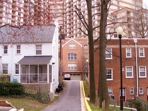
"Density" is one of those words that gets tossed around a lot with little care for what it actually means, kind of like "scale" or "quality of life." However, the word only refers to a number representing the proportion between an amount of something (like people) in a given space, and that number is meaningless without any context.
What does density look like? Or, more specifically, what does a dense neighborhood in Montgomery County look like? The 2010 Census results are slowly trickling out, but I looked at the 2009 American Community Survey for MoCo to see where the county's ten densest census tracts were. While census tracts don't always conform to accepted neighborhood boundaries, they can show us where people in MoCo are concentrated.
When I reached out to commenters earlier this week, many of them suggested that the county's densest places were all in downtowns, like Wheaton, Bethesda or Silver Spring. Much to my surprise, they're far more diverse than that. Some are in urban centers like downtown Silver Spring, while others are farther out, miles from a Metro station. Some are several decades old, while others are still being finished today. Not all of them have tall buildings, and not all of them look like the traditional idea of an "urban" place.
This creates a number of challenges, namely what we do with the thousands of (often low-income) people who live in dense neighborhoods far from jobs, shopping or other amenities they need. If you look at a list of the ten fastest-growing places in Montgomery County (which we'll talk about next week), you'll see that most of them are well outside the Beltway. This isn't a good thing. In fact, it only means that many of Montgomery County's current problems - traffic, the jobs/housing divide, and so on - will only get worse.
Anyway. Here are the ten densest census tracts in Montgomery County, all to scale and taken from Bing Maps. Scroll down to see them in a nifty slideshow:
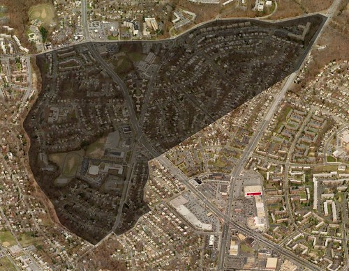
Census Tract 7020
Land Area: 0.38 square miles
2000 Population: 5,275
2000 Density: 13,808.90 people/sq.mi.
2009 Population: 4,927
2009 Density: 12,897.91 people/sq.mi.
Population Change: -7.06%
Nearest Metro: Takoma (2.2 miles)
Place in 2000: #7
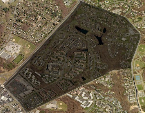
Census Tract 7014-16
Land Area: 0.54 square miles
2000 Population: 6,819
2000 Density: 12,698.32 people/sq.mi.
2009 Population: 7,191
2009 Density: 13,391.06 people/sq.mi.
Population Change: 5.17%
Nearest Metro: Glenmont (6.4 miles)
Place in 2000: #11
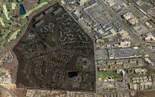
Census Tract 7009-05
Land Area: 0.30 square miles
2000 Population: 3,944
2000 Density: 13,016.50 people/sq.mi.
2009 Population: 4,223
2009 Density: 13,937.29 people/sq.mi.
Population Change: 6.61%
Nearest Metro: Twinbrook (.5 miles)
Place in 2000: #9
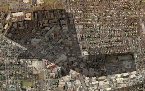
Census Tract 7048-01
Land Area: 0.28 square miles
2000 Population: 3,417
2000 Density: 12,160.14 people/sq.mi.
2009 Population: 4,012
2009 Density: 14,277.58 people/sq.mi.
Population Change: 14.83%
Nearest Metro: Bethesda (.1 miles)
Place in 2000: #13
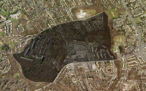
Census Tract 7023-01
Land Area: 0.24 square miles
2000 Population: 3,783
2000 Density: 15,632.23 people/sq.mi.
2009 Population: 4,115
2009 Density: 17,004.13 people/sq.mi.
Population Change: 8.07%
Nearest Metro: Silver Spring (1.8 miles)
Place in 2000: #5
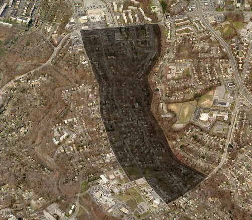
Census Tract 7019
Land Area: 0.17 square miles
2000 Population: 3,218
2000 Density: 18,494.25 people/sq.mi.
2009 Population: 3,350
2009 Density: 19,252.87 people/sq.mi.
Population Change: 3.94%
Nearest Metro: Silver Spring (1.8 miles)
Place in 2000: #4
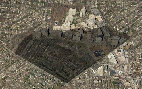
Census Tract 7056-02
Land Area: 0.21 square miles
2000 Population: 3,234
2000 Density: 15,548.08 people/sq.mi.
2009 Population: 4,197
2009 Density: 20,177.88 people/sq.mi.
Population Change: 22.94%
Nearest Metro: Friendship Heights (.1 miles)
Place in 2000: #6
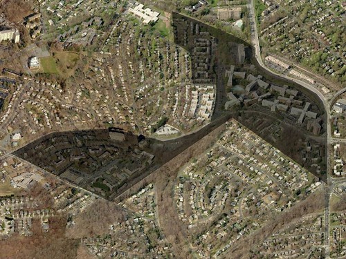
Census Tract 7026-02
Land Area: 0.20 square miles
2000 Population: 4,558
2000 Density: 22,904.52 people/sq.mi.
2009 Population: 4,640
2009 Density: 23,316.58 people/sq.mi.
Population Change: 1.77%
Nearest Metro: Silver Spring (.5 miles)
Place in 2000: #3
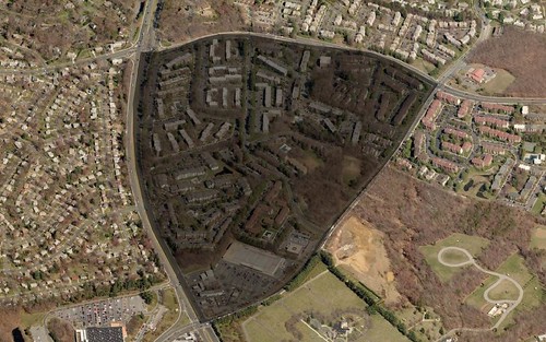
Census Tract 7032-13
Land Area: 0.22 square miles
2000 Population: 5,463
2000 Density: 24,719.46 people/sq.mi.
2009 Population: 5,634
2009 Density: 25,493.21 people/sq.mi.
Population Change: 3.04%
Nearest Metro: Glenmont (2 miles)
Place in 2000: #2
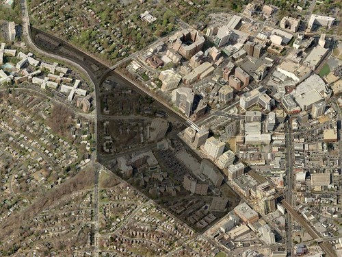
Census Tract 7026-01
Land Area: 0.13 square miles
2000 Population: 4,242
2000 Density: 32,630.77 people/sq.mi.
2009 Population: 4,016
2009 Density: 30,892.77 people/sq.mi.
Population Change: -5.63%
Nearest Metro: Silver Spring (.1 miles)
Place in 2000: #1
Check out this slideshow of the ten densest census tracts in Montgomery County. Click on the "show info" link to find out more about each one.

4 comments:
Very interesting read! Interesting where density is the highest.
I'm not surprised at all that Briggs Chaney is there...I expected both that area and the apartment communities in White Oak to be among the top ten.
Thanks for the list!
Interesting how three of the neighborhoods (clifton park, silver spring; long branch, silver spring; and long branch, takoma park) are adjacent to one another and could be merged into one large super-neighborhood.
I did predict, didn't I, that somewhere in Aspen Hill would be near the top of the lists? Yep, I sure did.
Right again, as always.
Post a Comment