
 |
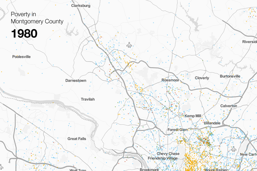
| Where poverty is in Montgomery County. Each dot represents 20 people. Blue dots are whites; yellow dots are blacks, green dots are Hispanics, and red dots are Asians. |
The Urban Institute, a DC-based think tank that looks at social and economic issues, made this awesome mapping tool that shows where very low-income people lived between 1980 to 2010. The Atlantic Cities notes that the maps show dramatic demographic shifts across the country, notably the suburbanization of poverty.
That's especially evident here in Montgomery County. 30 years ago, the county's only significant concentration of poverty was around close-in Langley Park and Long Branch, which had established themselves as immigrant gateways by the late 1970's.
But today, you can also find clusters of poverty throughout East County and the Upcounty, in Wheaton and Aspen Hill, in White Oak and Briggs Chaney, and even along I-270 in Gaithersburg and Germantown. Many of them have only emerged within the past decade.
Meanwhile, communities that have historically been affluent, like Bethesda or Olney, appear to have stayed the same. The area along Rockville Pike between Rockville Town Center and White Flint, where a considerable amount of new, high-end development is happening, seems to have actually become less poor.
We know that people increasingly desire urban neighborhoods, whether that's places like Columbia Heights in DC or downtown Silver Spring. But the flip side of that revitalization is that the poor often move or are pushed out into suburban areas. While these communities offer more space or better public services, they aren't always well-equipped to help low-income people.
Groups like IMPACT Silver Spring, which helps connect low-income people and immigrants to community groups and social services, began working in and around downtown Silver Spring in the 1990's. Today, IMPACT does outreach at garden apartment complexes in Gaithersburg and Briggs Chaney. Unlike close-in Silver Spring or Long Branch, these areas don't have easy access to shopping, jobs, public services or transit.
Here, fears of crime mean parents won't let their kids play outside. Even walking to the bus stop can be dangerous due to roads designed for speeding cars.
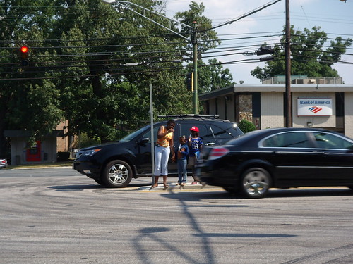 |
| A family tries to cross busy Columbia Pike in White Oak. |
Instead of working to combat the problem, more affluent neighbors fight any attempts at change or build fences in a lame attempt at keeping "undesirables" out. Meanwhile, kids growing up in these neighborhoods are often blocked from the high-quality public schools Montgomery County is known for.
The challenges that suburban poor face aren't necessarily different than those of their inner-city counterparts. But they're compounded by the built form of suburbia, which was designed under the assumption that everyone would have money and a car and does little to accommodate those who lack both.
Initiatives like the county's BRT plan or the White Oak Science Gateway will help bring transit, jobs and other amenities to these neighborhoods and improve residents' quality of life. But it'll be important to ensure that they aren't pushed out again into even more remote areas.
2 comments:
It would also be interesting to see the same data, but normalized to subtract out population growth.
Or in a similar vein, to normalize for population. To an extent, regions with dense populations = more potential people in poverty
Post a Comment