Tuesday, December 31, 2013

what if we ranked schools on their walkability?

Parents often choose schools for their kids based on test scores. But as more families seek out an urban lifestyle, what if we ranked schools on a kid's ability to walk there as well?


Locations of the region's most walkable high schools. Blue are schools in a "Walker's Paradise," red are "Very Walkable" schools, and green are "Somewhat Walkable." Click for an interactive map.

Studies show that kids who live in walkable neighborhoods get more exercise and are at reduced risk for obesity. Being able to walk to school teaches kids independence and a stronger sense of community as well.

So where are students most likely to be able to walk to and from school? One indicator is a school's Walk Score, a measure of its walkability. To find the region's most walkable schools, I looked at the Walk Score of 95 public high schools (both neighborhood and magnet) in the District, Montgomery and Prince George's counties in Maryland, and the city of Alexandria and Arlington and Fairfax counties in Virginia. Here's a spreadsheet of all of the schools.

Thursday, December 26, 2013

a utility line in olney carries more than gas

Utility lines provide us amenities like electricity, water, and gas, but they can also improve the physical connections between communities. A new video shows how one gas line in Montgomery County doubles as a trail and neighborhood gathering space.


John Wetmore, producer of the public access TV show Perils for Pedestrians, recently made a video about an underground pipeline in Olney. The line cuts a 200-foot-wide swath nearly two miles long through several neighborhoods, with just two streets crossing it.

Instead of closing it off, gas company Transcontinental opened the land above its underground pipeline in Olney to the public, building a foot and bike path along its entire length, as well as an informal playing field. Not only does this provide a usable open space for the neighborhood, but the trail's an important connection within the community, providing access to other trails, parks, a library, schools, and several shopping centers.

Tuesday, December 24, 2013

town square could wake up wheaton's sleepy downtown

Wheaton could get a new town square with an amphitheatre, performance space, and a dramatic ramp connecting it to the Metro station. It's part of Montgomery County's latest plan to revitalize Wheaton's struggling downtown, which officials released earlier this month.

This could be Wheaton's new town square. All images from the Montgomery County Department of General Services.

Representatives from the county and developers StonebridgeCarras and Bozzuto presented the new design December 11 in a public meeting at Wheaton High School. Montgomery picked them in September to build a square and a government office building on the site of a parking lot and the Mid-County Regional Services Center, a sort of "town hall" for Wheaton and surrounding areas, both located on Reedie Drive near Georgia Avenue.

It's hard to create an exciting urban place around an office building, since there isn't a lot of activity after the workers go home. Residents were skeptical of an earlier design for this project in September, but many of the changes the architects made in response will help make the streets and square livelier.

Thursday, December 12, 2013

see what montgomery BRT could look like

Now that Montgomery County's approved a plan for an 81-mile Bus Rapid Transit network, we can begin looking at how it will work in detail. A new map and video show what BRT might be like.

Map of a potential Montgomery BRT network.
The county's plan calls for dedicated bus lanes on major roads like Rockville Pike, Georgia Avenue, Columbia Pike and Veirs Mill Road, whether by repurposing existing car lanes or, where there's room, widening the road. Communities for Transit commissioned A county consultant made this subway-style map of the proposed system, showing potential routes and stops.

The map takes some liberties with the plan. Montgomery County has only decided what corridors can should have BRT service and where stops made sense, but not what routes would look like, and whether they'd be named for colors, letters, numbers, or something else. But it can help people take the leap and see how the system could benefit them.

Tuesday, December 10, 2013

valerie ervin steps down from council; what kind of person should represent district 5 next?

This morning, District 5 County Councilmember Valerie Ervin announced that she's leaving to head the Center for Working Families, a non-profit organization that advocates for social justice issues as they affect families.
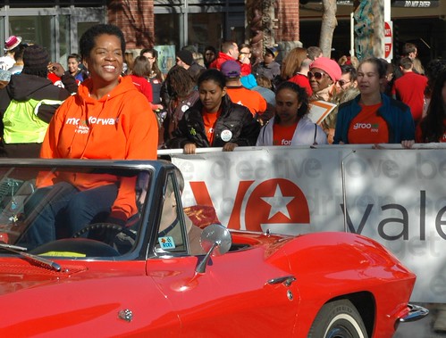
2012-11-17 Thanksgiving Parade Silver Spring - Councilmember Valerie Ervin
Ervin in the 2012 Silver Spring Thanksgiving Parade. Photo by Edward Kimmel on Flickr.

"After careful reflection and deliberation with my family, friends and supporters, I believe that leading this organization will enable me to have a greater impact on the issues I care about most," Ervin wrote in an email to supporters today. She'll commute from Montgomery County to the center, which is based in New York.

Ervin, who represents Silver Spring, Takoma Park, White Oak, and Burtonsville, took office in 2006. Previously, she served one term on the Board of Education and worked as an aide to at-large Councilmember George Leventhal. She was one year away from the end of her second term.

It wasn't clear before whether Ervin would run for reelection or challenge Ike Leggett for county executive. But now, the race for District 5 is wide open. The Council will appoint a successor in January, who will serve until her term ends in December 2014, and it's likely they'll pick someone who won't run.


Tuesday, December 3, 2013

wheaton safeway reaches for the sky, but a drag on the street

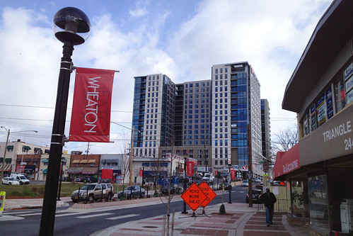
Last month, downtown Wheaton got a new Safeway, complete with 17 floors of apartments on top. While the new building gives Wheaton a skyline, it also has a lot of above-ground parking and blank walls, making the surrounding streets less inviting to pedestrians.

The Exchange, Seen From Reedie Drive
The Exchange, a new apartment building with a ground-level Safeway, towers over downtown Wheaton. All photos by the author.

Downtown Wheaton is having a residential boom, with 900 apartments in various stages of construction. Over half of them are in the Exchange, which is located across from the Metro station at Georgia Avenue and Reedie Drive and has a Safeway on its ground floor.

It's one of several residential projects with supermarkets being built around the region. Representatives from developer Patriot Realty says they were inspired by the Safeway with housing above at CityVista in Mount Vernon Square. There's also a Safeway with apartments above being built in Petworth, and a Giant with housing recently opened at the old O Street Market in Shaw.

Monday, December 2, 2013

sidewalks aren't just for walking

On narrow sidewalks, there's often a tension between different users and activities. But sidewalks in an urban place need to make room for people to do more than just walk through.

Crowded Sidewalks, Bethesda Row_cropped
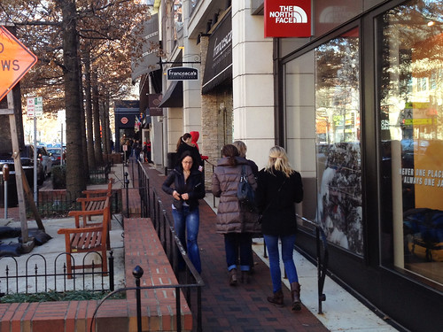
Pedestrians shuffle through the sidewalk on Bethesda Avenue. All photos by the author.

On Black Friday, I went to the Apple Store in Bethesda Row to get my computer checked out. Though the area is a really popular destination for shopping and dining, the sidewalks are surprisingly narrow, and seemingly designed to make walking difficult and unpleasant.

Here's the sidewalk two doors down from the Apple Store on Bethesda Avenue. Next to the curb, there's a row of big, mature street trees in large, fenced-off planters. Where the buildings step back, there's also a little seating area with some benches.

The level of the street falls about a foot here, meaning the seating area is actually below the sidewalk. So there's a brick wall around the benches, just in case anyone falls.