UPDATE: Our friend Matt Johnson from GGW explains what control cities actually are and how the names of certain places end up on highway signs.
Before the InterCounty Connector opened two weeks ago, I've wondered what
the exits along the new highway would be called, since much of its route through East County goes through
places that are called "Silver Spring". Over Thanksgiving weekend, I got to drive the full length of the road for the first time, and I found my answer.
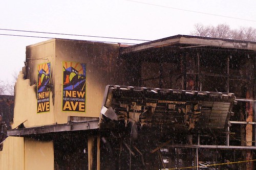
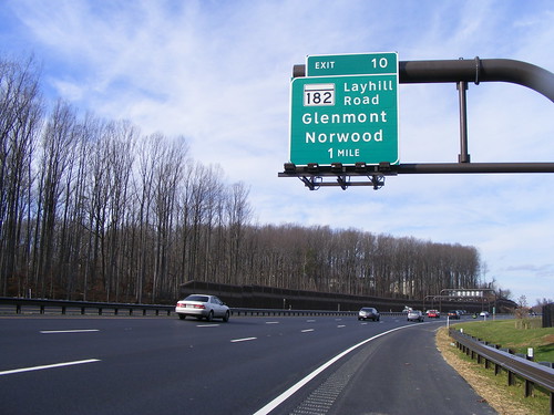
There is a "Silver Spring" exit, at Route 29. The Georgia Avenue exits are signed "Olney" and "Wheaton," which makes sense, as do the exits for "Ashton" and "White Oak" at New Hampshire Avenue. Things get weird at Layhill Road. There, you can go south for "Glenmont" or north for "Norwood."
The
American Association of State Highway and Transportation Officials (AASHTO), which sets guidelines for highway design throughout the United States, has
rules for listing "control cities" on highway signs. I've never read them, but I'm of the understanding that control cities usually have to be of a certain size to appear on a sign. Also, I imagine that people have to acknowledge them as actual places that, you know, exist.
Glenmont generally makes sense, because it has a
Metro station and is
generally recognized as a place, though I've never heard anyone say they "live in" Glenmont rather than Silver Spring or Wheaton.
But Norwood? I'm less convinced. There's Norwood Road, which connects to Layhill Road, but I've never heard of a "Norwood, Maryland," and when I entered it into Google Maps, they
sent me to Norwood, Massachusetts. OpenStreetMap, the user-generated map, took me to
the intersection of Norwood Road and Layhill Road, just north of the ICC.
So I looked at that junction and was even more confused.
Google Maps calls it "Colesville". Go west on Norwood Road and you'll find the
Sandy Spring Friends School, which not surprisingly gives its address as "Sandy Spring," but go east and there's
Blake High School, which says it's in "Silver Spring."
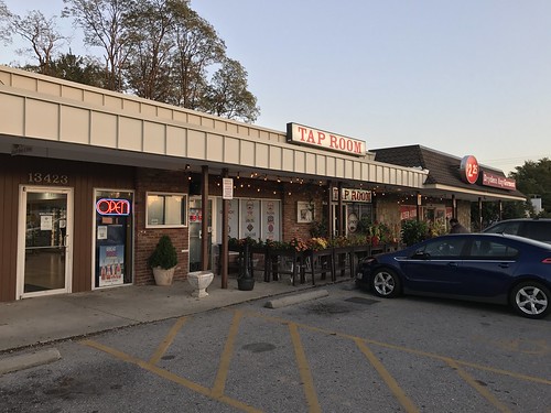
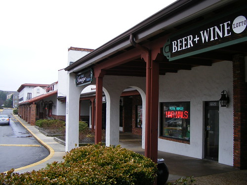
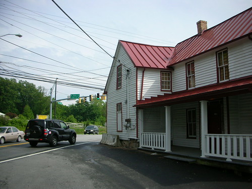 The Red Door Store today.
Then there's the Red Door Store, a
beer, wine and deli in a 150-year-old building right at the corner of Norwood and Layhill that
closed in 2007. According to the Sandy Spring Museum, the Red Door Store was
once a post office for a village called Norwood. Stanley Stabler, who grew up in the area nearly a century ago (and whose family name
appears on a street nearby), recalls what the area was like:
Norwood at the time was known as Holland's Corner. Where the Red Door Country Store trades today, James Holland opened a store about 1860 and in 1889 became the first postmaster. Nearby was a scales and a smithy run by Lawrence Budd. All around stood fine homes: Snowden Manor of the Quaker Hollands, Llewellyn Fields, Plainfield, Woodlawn, and the home called Norwood.
Map of historic Norwood courtesy of the Sandy Spring Museum.
So, let's get this clear: Norwood was a house, then a post office. The village of Holland's Corner eventually became the village of Norwood around 1890. And today, it's either Colesville, Sandy Spring, or more likely Silver Spring.
Given that convoluted history, perhaps the real question is what Norwood
will be. Before Francis Preston Blair
discovered the Silver Spring, the area around Georgia Avenue and Colesville Road was called "Simpsonville." The Sandy Spring Museum's website lists
all sorts of places in East County that have been lost to the sands of time, like Oakdale and Cincinnati. With Norwood's newfound status as a highway exit, it doesn't have to go the same way.
Who knows? In twenty years, people might say they live in Norwood rather than Sandy Spring, Silver Spring or anything else. Of course, it would help if the Red Door Store reopened. Norwood doesn't have much of a reason to exist without, you know, actual things to do there.